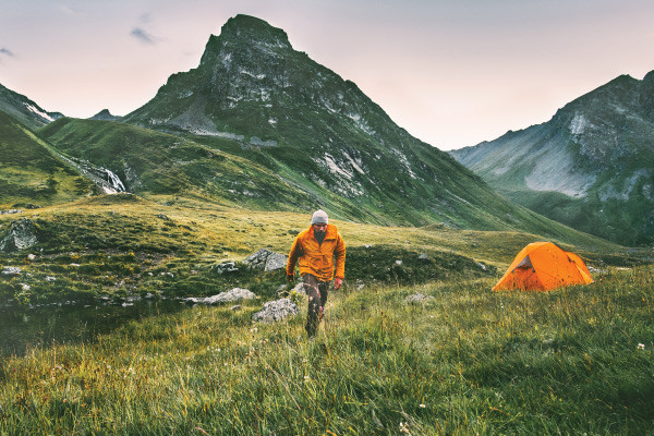
Loneliest Campsites in the Lower 48
Posted by Kristin Smith on 22nd Jun 2020
With people turning to nature in droves this summer, solitude will be in short supply. But not at these seven sits where you can pitch your tent in peace. Make sure to check local COVID policies and park openings, then grab your pack, snag a permit, and head to one of these seven spots.
Sahale Glacier Camp
North Cascades National Park, WA
It takes 6 miles and 4,000 feet of elevation gain to reach this site, but the views will make you forget all about the struggle. Perched on the moraine at the edge of Sahale Glacier, the campsites here are each circled by low rock walls for shelter against the wind. Across the valley, the crack and roar of icefall echoes from the Quien Sabe Glacier, clinging to the cliffs of Forbidden and Torment Peaks. To one side is ice; to the other, empty space until the wind runs up against the wall of the Picket Range. Permits are first-come, first-serve, and limited, and with plenty of space between each tent site crowds you’ll have all the elbowroom you want to enjoy the view.
Permit Wilderness Information Center, Marblemount Contact North Cascades National Park
"Shrubs" by John Loo is licensed under CC BY 2.0
Santa Rosa Island Beaches
Channel Islands National Park, CA
With no signage or established trails, Santa Rosa Island is a perfect escape for backpackers with strong navigation skills. This is a California now lost to time, the shoreline nearly unchanged since the arrival of the Spanish 340 years ago. After being dropped at the Bechers Bay Pier by boat or plane, link together dirt roads, wildlife paths, and beach walks to reach some of the 55 miles of Santa Rosa’s undeveloped shoreline. Be prepared for a heavy pack; only one campground on the island has potable water. The southeastern beaches are open from August 15 to September 15, and nearly all the island’s beaches are open for camping from September 16 to December 31.
Permit required; can be reserved in advance Contact Channel Islands National Park
"Canyonlands National Park" by GraceFamily is licensed under CC BY 2.0
The Maze Overlook
Canyonlands National Park, UT
No one can argue that the Maze is aptly named. This winding labyrinth of red-orange sandstone covers the southwest section of Canyonlands National Park and is the park’s least-visited section. Trails here are often unmarked and minimally maintained, so solid route-finding skills are key. The trade-off, though, is worth it: miles and miles of desert all to yourself. Perch at the edge of this wilderness at the Maze Overlook campsite, pitching your tent just a few feet back from the cliff’s edge and seemingly endless views of desert towers and mesas. Park at the North Point Road Junction, then follow North Trail Canyon for 12.5 miles to reach the site.
Permit required; can be reserved Contact Canyonlands National Park
"100 Mile Wilderness (8)" by John Hayes (gravelboy) is licensed under CC BY-SA 2.0
Nahmakanta Lake
100 Mile Wilderness, ME
This campsite comes at the end of an 18.5-mile loop in Maine’s 100 Mile Wilderness, one of the most remote regions in the East. Pitch your tent right on the beach of 3.5-mile long Nahmakanta Lake and keep your eyes peeled for moose—you’ll see more of them than people. The loop starts with a number of stream crossings before heading up the line of several Debsconeag Ponds, then turns briefly onto the Appalachian Trail and climbs through old-growth spruce and pine before dropping 3.8 miles down to the lake and your camp.
Permit none Contact Nahmakanta Public Lands
File:Dark sunset over Boundary Waters (Unsplash).jpg" by dan carlson is licensed under CC0 1.0
Rock of Ages Lake
Boundary Waters Canoe Area Wilderness, MN
The beginning of the hike can be swampy, but that just keeps the crowds away. Start at the Powwow Trail trailhead on Forest Road 377. After the first few miles turn left onto drier ground, passing Campfire Lake, Myth Lake, and Superstition Lake. The isolated, otherworldly feel of the path is buoyed by the place-names, but the lack of paddlers (rare, for the Boundary Waters) and the distant sound of wolves doesn’t hurt. Pitch your tent between Rock Of Ages, Mirror, and Path Lakes, then sit back for the lakefront sunset show.
Permit required; by quota during the summer Contact Boundary Waters Canoe Area Wilderness
Crescent Lake
Yellowstone National Park, MT
Head to the northwesternmost corner of Yellowstone and a perfectly lonely alpine lake to snag this spot. The entire loop past the campsite is 22.5 miles, climbing to the very edge of the park and over several creeks. The campsite itself is set at the edge of a classic mountain cirque, with crystalline water just past your backcountry doorstep. Though not frequented by humans, this loop is a wildlife hot-spot; bring your bear spray and binoculars.
Permit required; only available in-person Contact Yellowstone National Park
"Twilight Time at the Gulf" by Charles Patrick Ewing is licensed under CC BY 2.0
Pavilion Key
Everglades National Park, FL
The ten-mile paddle weeds out most backpackers; the challenge of navigating through scores of mangrove islands dissuades even more. But for those with the skills and the determination to kayak, canoe, or even paddleboard to this remote campsite in the Ten Thousand Islands region of Everglades National Park, an impossible white sand beach and miles of human-free barrier islands await. Pods of dolphins often play offshore, and the sunsets over the Gulf of Mexico blaze across the water in vivid rose and gold. Make sure to hang your food; the raccoons here can pop open kayak holds like nothing.
Permit required; only available in-person during the winter season Contact Everglades National Park
Written by Kristin Smith for Backpacker and legally licensed through the Matcha publisher network. Please direct all licensing questions to legal@getmatcha.com.
Share on:

